Claude Code / Prompt
Map everywhere you’ve been,
from your camera roll.
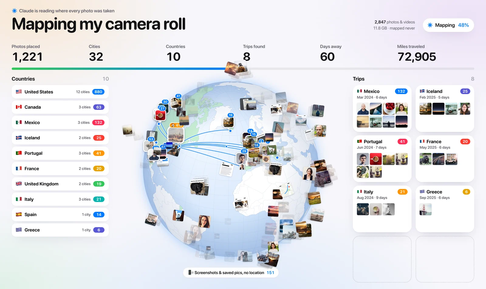
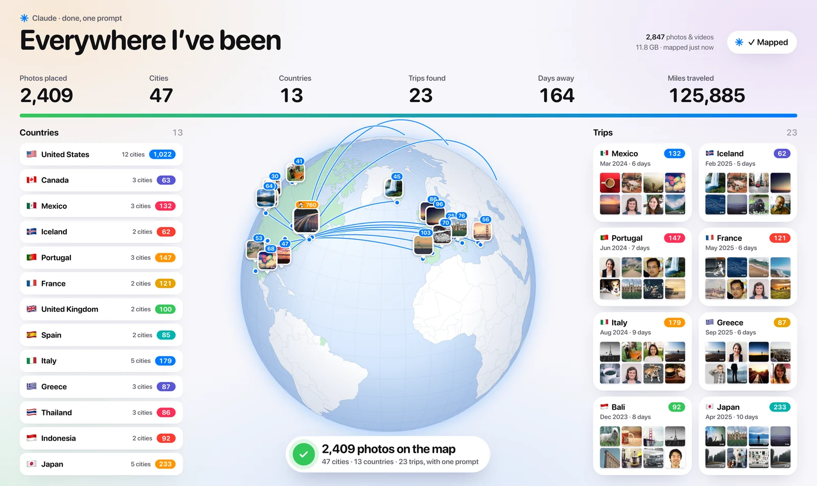
Claude reads the location saved inside every photo and video, works out your home and your trips and builds a 3D globe of every city and country you’ve been to, with your photos pinned on it. Nothing gets moved or uploaded.
You commented MAP. Here's the exact prompt from the reel and the 5-minute setup.
By Artem Novitckii · November 1, 2026
Works on a Mac · Needs Claude Code · About 5 minutes to set up
Export your camera roll.
Claude works with files, so first copy your photos into a normal folder. Your originals stay in Photos untouched.
- Make a new folder on your Desktop called CameraRoll.
- Open the Photos app and select everything with Cmd + A.
- Go to File → Export → Export Unmodified Original and pick the CameraRoll folder. This keeps the location saved in each photo.
Already exported it for the camera roll sorting prompt? Use the same folder. It works whether you sorted it or not.
Set up Claude Code.
You need Claude Code, exiftool, which reads the location and date saved in each photo, and ffmpeg, which grabs a frame from your videos for the pins. Open the Terminal app and run:
brew install exiftool ffmpeg
cd ~/Desktop
claude
No Homebrew yet? Install it first from brew.sh. It's one line to copy and paste.
The prompt.
Copy all of it, paste it into Claude Code and let it run. When it's done, your globe opens in the browser by itself.
# Map everywhere I've been

## Your role
You're my travel historian. You can run shell commands on my Mac.
Goal: turn the location saved inside my photos into a map of everywhere I've been.

## Context
- My camera roll is exported to ~/Desktop/CameraRoll (subfolders are fine).
- iPhone photos and videos keep GPS + date inside the file. Screenshots and saved pics don't.
- Tools: exiftool and ffmpeg (Homebrew), plus python3 or node for the number crunching.

## Hard rules
1. READ ONLY. NEVER move, rename, edit or delete anything in ~/Desktop/CameraRoll.
2. Everything you create goes in ~/Desktop/MyMap/.
3. Nothing gets uploaded. My photos and locations stay on this Mac.

## Step 1: Read where and when every photo was taken
mkdir -p ~/Desktop/MyMap/thumbs
exiftool -r -n -q -csv -i _Review -ext heic -ext jpg -ext jpeg -ext png -ext mov -ext mp4 -GPSLatitude -GPSLongitude -DateTimeOriginal -CreationDate -CreateDate ~/Desktop/CameraRoll > ~/Desktop/MyMap/photos.csv
- Date = DateTimeOriginal, else CreationDate, else CreateDate (ignore 0000:00:00).
- No GPS, or 0,0: count it as "no location" and leave it off the map.

## Step 2: Turn coordinates into places
- Group photos within 25 km of each other into one place.
- Name each place offline with GeoNames (free, no API key, no rate limits):
curl -sL -o /tmp/cities.zip https://download.geonames.org/export/dump/cities15000.zip && unzip -oq /tmp/cities.zip -d /tmp
- Each place = nearest city + country (country names: countryInfo.txt, same site).

## Step 3: Find home and my trips
- Home = the place with photos in the most different months.
- A trip = days in a row with photos more than 100 miles from home (a 2-day gap is still the same trip).
- For each trip: name (country, or city if it's in my home country), dates, days, cities, photos.
- Miles traveled = home → each trip and back, as the crow flies.

## Step 4: Make thumbnails
For every place, pick up to 12 photos spread across its dates and make 400px previews:
sips -Z 400 -s format jpeg "$photo" --out ~/Desktop/MyMap/thumbs/$id.jpg
ffmpeg -loglevel error -ss 1 -i "$video" -frames:v 1 -vf scale=400:-1 ~/Desktop/MyMap/thumbs/$id.jpg

## Step 5: Build the map
Write ~/Desktop/MyMap/index.html, ONE file that opens with a double-click (data inline as JSON):
- A slowly spinning 3D globe: globe.gl from https://unpkg.com/globe.gl and country shapes from https://unpkg.com/world-atlas@2/countries-110m.json
- Light look: pale blue ocean, white land, every country I've visited tinted green.
- A photo pin on every place (its best thumbnail + photo count) and an arc from home to every trip.
- Click a pin or a trip → grid of its photos. Sidebar: countries by photo count, trips newest first.
- Stats on top: photos placed, cities, countries, trips, days away, miles traveled.

## Step 6: Report back
Run: open ~/Desktop/MyMap/index.html
Then tell me: my top 5 places, the furthest place from home, my longest trip,
and how many photos had no location.Good to know.
- Read-only. Claude never moves, renames or deletes a photo. Everything it makes goes into a new MyMap folder on your Desktop.
- Nothing gets uploaded. The place names come from a free city list Claude downloads once, and your photos and locations stay on your Mac.
- Light on your plan. Claude reads the location from each file’s data instead of looking at every image, so this uses far less than the sorting prompt.
- Only a few photos showed up? Check that Location Services is on for the Camera app, and that you exported with location (Export Unmodified Original, or tick Location Information in the normal export).
- Want it different? Ask Claude for a flat map, a dark globe or a page per trip. It already has all your places.
Get the camera roll map prompt
Unlock the full prompt and setup, plus every other resource in the library. Free, one email a week, unsubscribe anytime.